
Children’s Illustrated Atlas

Children’s Illustrated Atlas
Children’s Illustrated Atlas Book Description
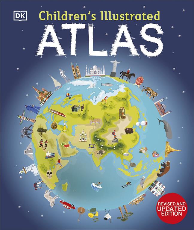
Readers will love the vibrant maps and playful drawings that fill Children’s Illustrated Atlas. This English‑language atlas invites young explorers to travel across continents, oceans, and countries without leaving their homes. Each double‑page spread combines clear illustrations with simple facts, making geography fun and easy to understand. The book encourages curiosity, helping children learn where places are and why they matter.
Fans of adventure will enjoy the interactive “find‑the‑spot” games hidden on every page. Meanwhile, parents appreciate the age‑appropriate language that supports early reading skills. The atlas covers everything from famous landmarks to wildlife habitats, giving a well‑rounded picture of our world. Additionally, the sturdy board pages withstand frequent handling, so kids can explore again and again.
Inside the atlas, colorful icons mark landmarks, rivers, and mountains, while short captions explain each feature. Moreover, a glossary at the back defines new words, helping young readers build vocabulary. The layout is clean, with generous margins and bold headings that guide the eye. Therefore, the book feels both educational and entertaining, striking a perfect balance for curious minds.
Key Features of Children’s Illustrated Atlas
Readers can discover 50 detailed maps that span every continent. Each map includes vibrant illustrations, clear labels, and fun facts about cultures, climates, and animals. Furthermore, the atlas offers interactive quizzes that test knowledge after each region, encouraging active learning. The durable board format ensures the pages stay flat, making it easy for little hands to turn.
Additionally, the book includes a removable world‑map poster that can be displayed on a bedroom wall. This poster reinforces geography lessons and adds a decorative touch to any space. The glossary provides simple definitions for terms like “equator” and “peninsula,” supporting language development. Because the text is written in short sentences, children can read independently or with a caregiver.
Why Read This Book?
The story behind each illustration sparks imagination and invites discussion. Fans of travel will feel a sense of wonder as they explore distant places through vivid art. Moreover, the book promotes cultural awareness by highlighting diverse customs and traditions. Readers will develop a global perspective, learning that the world is full of exciting differences.
Parents choose this atlas because it blends education with play. The engaging visuals keep children attentive, while the factual content meets early curriculum standards. Therefore, the book serves as a reliable resource for classroom activities and at‑home learning. Many readers report that their children become more eager to ask questions about the world.
About This Book
More detail about this book and its author can be found on Goodreads. Also, explore the best English books online in our store through this link. Children’s Illustrated Atlas is ready to inspire the next generation of explorers, offering a rich reading experience that combines fun, knowledge, and beautiful artwork.
| Author |
|---|
Only logged in customers who have purchased this product may leave a review.
Product Related

Out of stock
EGP1,050.00
Out of stock


Reviews
There are no reviews yet.